Severe Weather Threat to Central US
Amidst the Central Plains, millions are facing a looming threat of severe weather this Sunday, which could unleash tornadoes, sizable hail, and destructive winds. Meanwhile, in Houston, the aftermath of perilous storms has left hundreds of thousands without power, amidst oppressive heat.
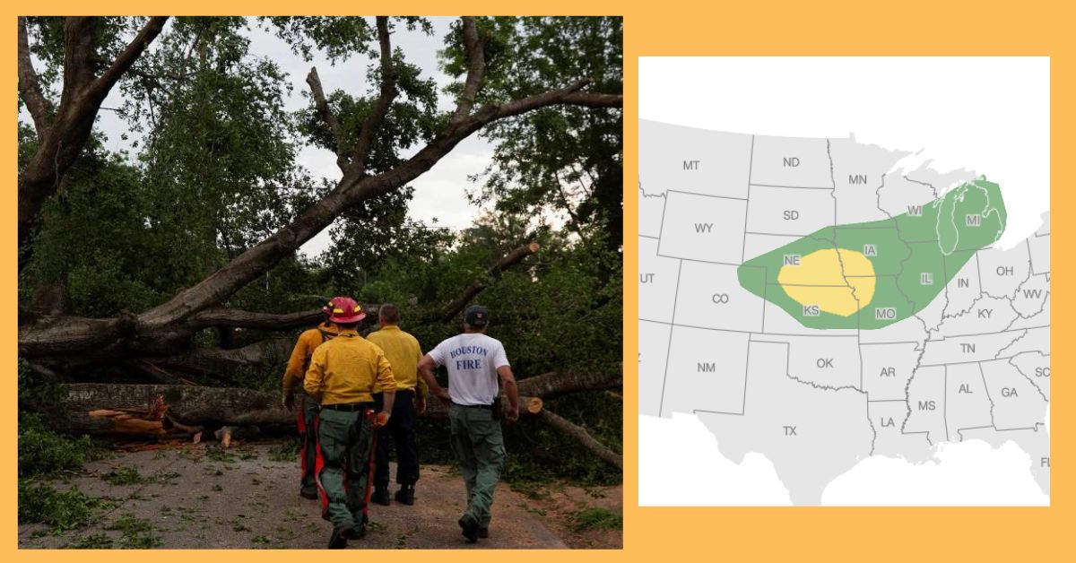
While stormy conditions are expected to ease along the central Gulf Coast, the danger of severe storms amplifies across the Central Plains from Sunday into Monday. An estimated 24 million individuals are under the threat of severe thunderstorms in parts of the Central Plains on Sunday.
According to the National Weather Service, a surface low-pressure system will usher in heavy rain and thunderstorms across portions of the Great Plains and Upper/Middle Mississippi Valley on Sunday. An elevated risk, rated at level 3 out of 5, spans western and central Kansas, encompassing cities like Dodge City, Salina, Hutchinson, Garden City, and Hays. Sunday’s storms could potentially bring wind gusts exceeding 75 mph, hail larger than 2 inches, and the possibility of tornadoes.
The National Weather Service in Wichita warns of scattered severe storms affecting the region on Sunday afternoon and evening. These storms could generate hail as large as tennis balls, wind gusts up to 80 mph, and the potential for tornado activity.
Along the east coast of Florida, a slight risk of severe thunderstorms, rated at level 2 out of 5, looms for Sunday, with large hail being a probable occurrence as per the Storm Prediction Center. Looking ahead, the Central US faces an escalating threat of severe weather and excessive rainfall through early next week, as per forecasts by the National Weather Service.
By Monday, the severity of thunderstorm risk diminishes slightly to level 2 out of 5 for the Central Plains, shifting eastwards to encompass parts of Nebraska, Kansas, southwest Iowa, and northwest Missouri, including cities like Kansas City and Omaha. Hail and strong wind gusts are anticipated as the primary threats.

The Storm Prediction Center cautions of possible severe thunderstorms across sections of Nebraska, Kansas, western Iowa, and northwest Missouri on Monday afternoon and night. Furthermore, there’s a chance of more isolated instances of strong to severe storms extending into parts of the Middle Mississippi Valley and southern Wisconsin.
The risk of severe thunderstorms persists into Tuesday across portions of the Mississippi Valley, with damaging winds remaining the primary concern, accompanied by the potential for large hail and tornadoes.
Recent Climate – Severe Weather Threat to Central US, Severe Weather Threat
